Walking the ancient Pilgrim’s route to the Holy Island of Lindisfarne
Length: 3 miles
Time: 75 – 90 minutes
Please note: only walk on a receding tide, barefoot or with waterproof shoes. Be prepared to get muddy legs.
Safety first: make sure you carefully read the instructions on when to cross. Tides cover the Pilgrim’s Way very quickly, and can catch you by surprise if you’re not careful. Key safety points:
- DO NOT use the council’s safe crossing tables for Holy Island as a guide for when the Pilgrim’s Way is walkable. They are intended for cars crossing on the causeway road which has a longer ‘dry’ time than the Pilgrim’s route. Read our advice below to plan your walk.
- DO NOT Cross at dusk, in the dark or in bad weather conditions.
Please don’t let all the warnings put you off walking the route. It’s a great experience, and as long as you follow our advice, you should have a lovely, safe experience!
Route information
Like saints, monks, villagers and (of course) pilgrims you too can walk to the Holy Island of Lindisfarne along the ancient route that has been used long before a modern road was introduced to allow the fast crossing of cars, Amazon deliveries and council bin lorries. This is the original route that anyone visiting the island had to follow for centuries, until the 1950s, when the causeway road was built.
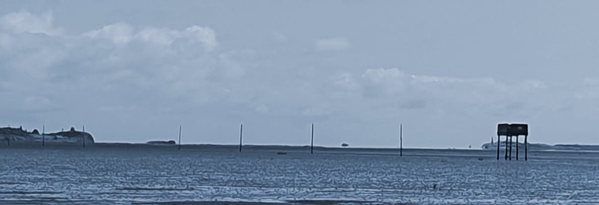
The Pilgrim’s Way is marked out by poles in the sand and is more direct than the causeway road (used by all other traffic) It is still a popular way to arrive on Holy Island, walking the three-mile Pilgrim’s Way across the sands from the end of the causeway to the village, used by many visitors to the island, including pilgrims and long-distance walkers who have walked St. Cuthbert’s Way or St. Oswald’s Way.
Getting to the start of the Pilgrim’s Way on foot from the A1
If this is the last leg of your long-distance walk (for example St Cuthbert’s Way), or you used public transport to get to the turning to Holy Island from the A1, the walk to the start of the Pilgrim’s Way takes about 35 minutes (1.8 miles). Please take this into account when you look at tide times and plan your crossing time. If you are early, you can always stop for a coffee and a bite at the cafe and restaurant at the Barn at Beal, which is about halfway to the start of the crossing. The final stretch of the road is quite narrow and it is safer to take the walkers path next to it. You’ll see a gate to this path just after the turning to the Barn at Beal.
Getting to the start of the Pilgrim’s Way from Berwick-upon-Tweed.
There is a bus (477) to the island, but it usually only comes to the island twice a week, and its timetable is not always suitable for the the required start time for the walk.
A popular option, if you plan to stay overnight on the island, is to take a taxi from Berwick-upon-Tweed. Ask the driver to drop you off at the start of the walk and then to deliver your luggage to your lodgings.
How to Cross the Pilgrim’s Way Safely, with tides in mind
IMPORTANT: the council’s safe crossing times for Holy Island are only for the road. It is not safe to use them for the Pilgrim’s Way unless you use the method described below.
The Pilgrim’s Way should only be attempted on a receding tide and it should be completed before the tide turns into a rising tide. To plan for the best time to cross, consult Northumberland council’s tide times page (ONLY AS A GUIDE TO THE CALCULATION BELOW) and aim to start and finish your walk across the Pilgrim’s Path within the first half of the time range deemed ‘safe to cross’.
The calculation:
- Look at the safe crossing times for cars published by Northumberland Council.
- Find the middle point of the safe crossing time (in green) for the time of day you wish to cross (e.g. if the safe crossing time is 9am to 3pm, the middle point is 12-noon).
- You should start crossing at least 1 hour and 15 minutes before that middle point, or even earlier, if the water has receded.
Example calculation:
- Council ‘Safe to Cross’ times for cars are 10am to 4pm that day (six hours, which you will divide by 2 to find the middle point).
- The middle point will therefore be 10am + 3 hours = 1pm, by which point you should have competed your walk.
- Now you know the middle point, you should start at least 75 minutes (1h15m) beforehand.
- Conclusion: in this example, you should start your walk by 11.45am
- Remember: tides times are different each day, so the above is just an example.
The walk can be done in approximately 75 minutes and ends about half a mile from the village centre. ideally you should set out even earlier, as soon as the receding tide allows. In the worst case, you’ll have to wait (or wade) a little. Finally, if the weather’s bad, and the tide doesn’t seem like it has receded enough, don’t risk it.
Alternative calculation:
Some walkers prefer to find out the actual time of the lowest tide point and then start their walk 75 minutes before that. This is fine if you understand the local tides and also check tide heights for that day. The advantage of using the council times as a basis for a calculation is that they take into account the height of tides both ends of the low tide, and so you are more likely to be walking at the most appropriate time.
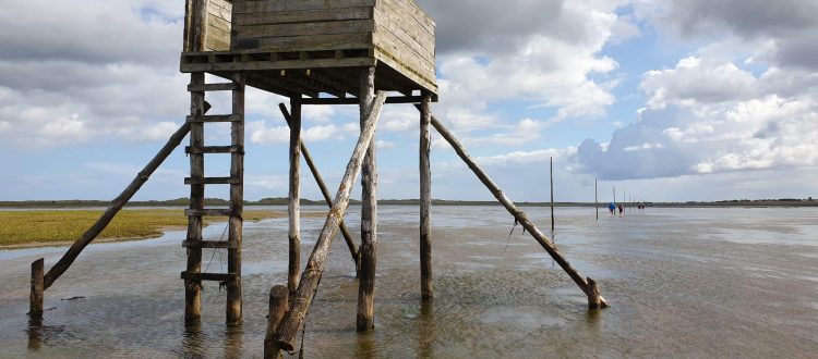
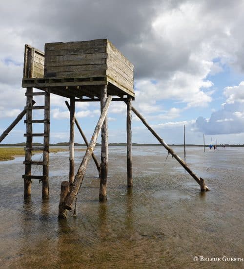
If you get into trouble along the route, aim for one of the refuge towers along the way and dial 999, asking for the Coastguard.
What to wear for crossing the Pilgrim’s Way
We suggest you only attempt to cross the Pilgrim’s Path barefoot or in wellingtons or waterproof footwear. The route is muddy and you will end up with muddy legs. You may wish to carry a bag with your normal footwear with you, with a towel to wipe off your feet at the end of the Path. In the summer months consider taking sun cream, a hat and a bottle of water (to drink from, and then to wash the sand from your feet on the other end).

The Pilgrim’s Way: start to finish
Where to start the Pilgrim’s Way
The route traditionally starts from the end of the causeway on the mainland side, but it is easier to start from the road bridge/causeway refuge, as otherwise you would have to ford a river. It is easier to walk across the bridge towards oncoming traffic (on the right-hand side as this is where you will also access the Pilgrim’s Way). Be careful of traffic when crossing the bridge as it is quite narrow here.
Opposite the refuge, look diagonally across to your right and you should see a line of stakes/poles going into the distance. Find a safe place to leave the road onto the sands and head towards the first pole.
Walking along the sands to Holy Island
Once at the first pole, follow the line of poles east and this will take you all the way to the end of the Pilgrim’s Path.
Along the way, you will see two pedestrian refuges, there for anyone who is caught out by the tides. Please note, these have no roofs and so are not protected from the elements. The lowest part of the Pilgrim’s Path (close to the Holy Island end) is often flooded. It is easier, if it is flooded, to skirt the flooded area and then go back to the straight path where it is drier. There will also be areas of mud and you may need to wade through small areas of water, which shouldn’t be more than a foot or so deep. Be prepared to get muddy legs, but that is part of the experience (and hence better barefoot, wellies might get stuck in the mud or just fill with water). At points, especially in the middle, the mud might be slippery, so watch your step.
Arriving on the Island
At the end of the path, there is a convenient bench, where you can clean your feet and put your socks and shoes on, if you have walked barefoot. Holy Island village is only a 5 minute walk from this spot. Follow the path behind and to the left of the bench towards the village, crossing over close to the car park entrance, from where you follow the pavement to the village centre.
If you are staying with us at Belvue Guesthouse, we are the seventh house on the left after the car park.
If you’re staying on Holy Island and want to get to the starting point
Anyone staying in the village who wants to walk the Pilgrim’s Way will need to get someone to drop them off at the end of the causeway on the mainland side. Apart from getting a lift, you may be able to get a #477 bus (although these are sporadic) and ask to be dropped off at the end of the causeway (please ask the driver before you get on).
For further options see the ‘There and back again’ section below.
Guided tours for the Pilgrim’s Way
If you would like someone to lead you on a walk across the causeway, a local guide can take you across and will ensure a safe and enjoyable passage on the Pilgrim’s Path, with the added benefit that both the options noted here are knowledgeable about Holy Island’s history and wildlife. For further info please visit the Holy Island Hikes (01289 389 225) or Footsteps Tours (tel. 07847 506 399).
Joining the Northern Cross Pilgrims
Northern Cross organises pilgrimages to Holy Island every Easter, carrying large wooden crosses. You can join the last leg of their journey, as they walk across the sands to Holy Island. More details can be found on our Christmas and Easter page.
There and back again
One of the challenges for visitors wishing to walk the Pilgrim’s way is how to get to the start of the route (or back to the beginning once you’ve done it).
A common question is ‘Can I walk it both ways?’ Our unequivocal advice is that you shouldn’t walk across the sands and then back again. The reason is that you should always be walking when the tide is receding. If you start the walk 75 minutes before the midpoint (as described above), then by the time you start your walk back, you’ll be risking getting caught out by the rising tide. We know some people do, but they usually have enough knowledge to calculate tide heights and walk within a safe window or do their walk on a day that allows them to start a lot earlier. Unless you have local knowledge, it is a risky venture and you should not attempt it.
Your options are as follows:
- Use one of the public transport options to get to the starting point (as already noted). Bus services to the island are quite limited, so you’ll have to plan it well, and there might not be a bus/shuttle on the day of your visit or at a good time for a crossing. The other option is to book a taxi to take you there. This isn’t cheap (they’ll have to come from Berwick), but if you ring them and ask, that might be an option. See our article about public transport for the island for more information, timetables and taxi numbers.
- Take a guide to walk you across and take care of transport. See the guided tours section above.
- Walk to the island along the Pilgrim’s Way. Spend the tide on the island and then walk back. This is a great option if you’d like to explore the island and then wait until it is safe to walk back again. Obviously, this is only an option if the tide times on the particular day work for this plan. Check them carefully.
- If tides allow, you may be able to walk on the tarmac road to the starting point in time to start your walk back across the sands. This requires a further careful calculation. It works as follows:
– First figure out the correct time for you to start your walk across the sands (using the calculation in this article). By that time YOU MUST reach the starting point (which is usually on the mainland side).
– The causeway tarmac road is open to traffic for longer than the safe crossing times for the Pilgrim’s way across the sands, so if you have time to walk along the road to and get to the starting point at the time indicated to start the foot crossing, then you can do so.
– The tarmac road’s distance from the island to the start of the causeway is about 3 miles. which takes around 60 minutes for an average walker (75 minutes from the centre of the village). Adjust this timing to your walking capabilities. You can usually set off earlier than the official road opening time, because the tide will be receding and if you come across water on the road, you simply have to wait a little until it clears.
– If the tide times on your particular date allow you the time to walk to the starting point along the tarmac road, get there in time and then walk back across the sands, then you can go ahead. If not, DON’T RISK IT. If the crossing window is narrow on a particular day, then it may not be possible.
** PLEASE DO NOT CONTACT US TO CONFIRM YOUR CALCULATIONS. As it takes time to triple-check whatever information we provide, we can’t take on this responsibility for the many visitors to the island. If you are staying with us at Belvue, then of course we’ll be happy to help.
Where to stay once you get to Holy Island?
With us, of course! Belvue Guesthouse on Holy Island is a short walk from the end of the Pilgrim’s Way. We are a small friendly guesthouse on Holy Island with two luxury king-size studios and one ‘no frills’ twin Pilgrim’s room. Details and booking here.


